Satellite and Ground Based Methane Detection: Complementary Tools
Methane emissions can be difficult to detect. The gas is invisible, often released intermittently, and can come from many different sources across a single oil and gas operation. Finding and addressing those emissions requires reliable information about where they are occurring, how significant they may be, and whether they are continuing over time.
Fortunately, the tools available to identify methane emissions have expanded considerably. Satellite methane detection has emerged as an important part of the picture, providing a way to observe large areas from above. At the same time, ground based technologies continue to provide detailed information at the facility and component level.
These approaches are sometimes discussed as though one might eventually replace the other. In practice, that is not necessarily the most useful way to look at them. Satellite and ground based detection provide different types of information, at different scales and with different strengths. When used together, they can provide a much more complete understanding of methane emissions.
Satellite Methane Detection; Seeing The Bigger Picture From Above
One of the biggest advantages of satellite methane detection is scale. A ground based technician or sensor can provide highly detailed information about a specific facility or piece of equipment. A satellite, by comparison, can observe enormous areas without requiring someone to physically visit each location.
This makes satellites particularly valuable for identifying larger emission events and potential hotspots. The International Energy Agency notes that satellite observations have significantly improved our understanding of methane emissions by allowing large emission sources to be identified across broad geographic areas. Newer satellite systems can also provide increasingly detailed observations of individual facilities and emission sources (International Energy Agency [IEA], 2026).
The scale of satellite methane detection can be especially useful in regions where facilities are spread across large areas. Rather than beginning with a site by site search, satellite observations can help identify where further investigation may be worthwhile.
There is also a growing example of this approach at the international level. The United Nations Environment Programme’s Methane Alert and Response System, known as MARS, uses data from more than 30 satellite instruments to identify major methane emission events and notify governments and companies so that action can be taken (United Nations Environment Programme [UNEP], 2026).
The important point to note is that identifying an emission is only the beginning. The real value comes from what happens next.
Ground Based Detection; Bringing The Investigation Closer
Once a potential emission has been identified, the next question is often much more specific: Where exactly is the methane coming from? In terms of source identification ground based detection can play an important role.
Ground based sensors can be positioned at or around a facility to observe methane at much closer range. Depending on the technology, these systems can help identify emissions from individual components, provide continuous measurements, or support personnel investigating a suspected leak.
The International Energy Agency describes ground based detection technologies as providing high sensitivity and temporal resolution. Handheld and on site instruments can be particularly useful for pinpointing leaks, confirming repairs, and conducting follow up investigations (IEA, 2026). This level of detail is difficult to achieve from space.
Imagine a satellite identifies an elevated methane signal over a large industrial site. That information can tell operators that something deserves attention, but it may not tell them exactly which valve, seal, connection, tank, or other component is responsible. A ground based measurement can bring the investigation down to that level and pinpoint the source.
This distinction is important because methane emissions are not all the same. Some may be large and relatively easy to identify from a distance. Others may be smaller but persistent, intermittent, or associated with individual components. A useful monitoring strategy needs to account for this range.
Different Perspectives On The Same Problem
A simple way to think about the difference is to imagine looking at a city from an airplane and then walking through one of its neighbourhoods. The aerial view provides context, it can show where activity is concentrated and help identify areas that warrant closer attention. The ground level view provides detail, it allows someone to examine individual buildings, roads, and infrastructure. Neither perspective can tell the entire story on its own.
The same principle applies to methane monitoring. Satellite methane detection can provide broad coverage and help identify significant emission events. Ground based technologies can then provide more detailed information about what is happening at a specific location.
The reverse can also be useful. Ground based monitoring may identify an issue that warrants further investigation, while satellite observations can provide additional context about whether emissions are occurring beyond the area being monitored on the ground.
This is one reason the IEA’s latest research emphasizes the importance of multi scale measurement approaches. Its Global Methane Tracker 2026 notes that effective methane management requires combinations of space based, airborne, and ground based measurements because different technologies capture different parts of the emissions picture (IEA, 2026).
Detection Is Only Useful If It Leads to Action
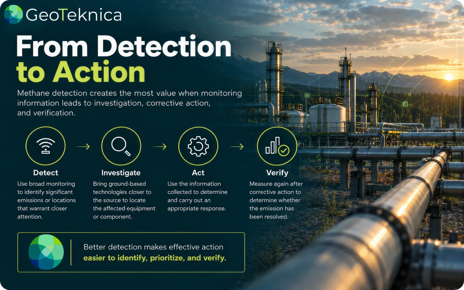
Another reason to think about methane detection as a connected system rather than a choice between technologies: detection by itself does not reduce emissions. The purpose of monitoring is to provide enough useful information for an operator to investigate an emission, understand its source, determine an appropriate response, and verify whether that response worked.
Satellite methane detection can help initiate that process by drawing attention to an emission that might otherwise go unnoticed. Ground based technologies can then help investigate the source and provide additional information for mitigation.
UNEP’s MARS program provides a real world example of this process. Its system is designed around four stages: detecting and attributing emissions, notifying relevant stakeholders, taking action, and tracking what happens afterward. The organization has documented cases where satellite notifications have contributed to mitigation activities in the oil and gas sector (UNEP, 2026).
The ongoing shift in how methane monitoring is being approached is tied to the objective to collect more data in order to support decision making. Monitoring and the data that comes out of it are unnecessary if there is no purpose for the knowledge.
Satellites Have Limitations Too
Satellite technology has made significant advances, but it is not a complete solution for every methane monitoring challenge. Satellites depend on observation conditions; cloud cover, sunlight, snow, complex terrain, vegetation, and offshore environments can all affect the ability to detect methane. Satellites also have detection thresholds, meaning smaller emissions may not be visible from space (UNEP, 2026).
Timing is another consideration. A satellite observation provides a measurement at a particular point in time. Methane emissions can be intermittent, meaning an emission may not necessarily be occurring when a satellite passes overhead.
Ground based systems can offer a different kind of coverage. Depending on the technology, sensors can monitor a location continuously or allow personnel to investigate a suspected source when needed. This does not make one approach better than the other. It highlights why having multiple ways to observe emissions can be valuable.
A More Complete Picture
The future of methane monitoring is unlikely to be defined by a single technology. Alternatively it has increasingly been about connecting different technologies and using each one where it provides the most value.
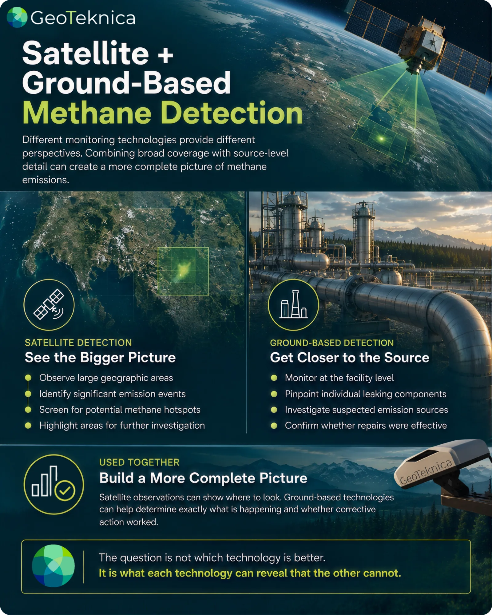
Satellite methane detection can help answer questions such as: Where are significant emissions occurring? Are there areas that deserve closer investigation? Are emissions appearing across a particular region or group of facilities?
Ground based detection can help answer different questions: Where exactly is the emission coming from? Is a particular component leaking? Is the emission still occurring? Did a repair resolve the problem?
When used together, these perspectives can create a stronger monitoring process. For example, a satellite observation could identify an unexpected methane plume over an operating area. That information could then prompt a ground based investigation. Once the source is located and repaired, ground based measurements could help confirm the result, while subsequent satellite observations could provide another layer of verification where conditions allow. The technologies are doing different jobs, but they are contributing to the same objective.
Better Information Supports Better Decisions
Methane management has become more data driven than ever before and can result in positive development for operators, regulators, communities, and the environment. The oil and gas industry has a practical reason to pursue better methane detection. Methane that escapes from an operation is a lost resource, while identifying and addressing unnecessary emissions can support operational efficiency and environmental performance at the same time.
At the same time, reducing methane emissions has significance well beyond an individual facility. Methane is a potent greenhouse gas, and reducing emissions can contribute to efforts to slow near term warming. The challenge is therefore not simply finding a technology that can detect methane. It is building monitoring approaches that can identify meaningful emissions and help turn that information into action.
Satellite methane detection and ground based monitoring each bring valuable capabilities to that process. The most useful question is not which technology is better, it is what each technology can tell us that the other cannot.
Combining broad visibility with detailed, on site information may ultimately provide the strongest foundation for finding emissions, understanding their sources, and taking action to reduce them. Better detection does not replace the need for action. It makes effective action easier to see, prioritize, and verify.
References
International Energy Agency. (2026). Global methane tracker 2026. IEA. https://www.iea.org/reports/global-methane-tracker-2026
United Nations Environment Programme. (2026). Methane Alert and Response System (MARS). United Nations Environment Programme. https://www.unep.org/topics/energy/methane/methane-alert-and-response-system-mars